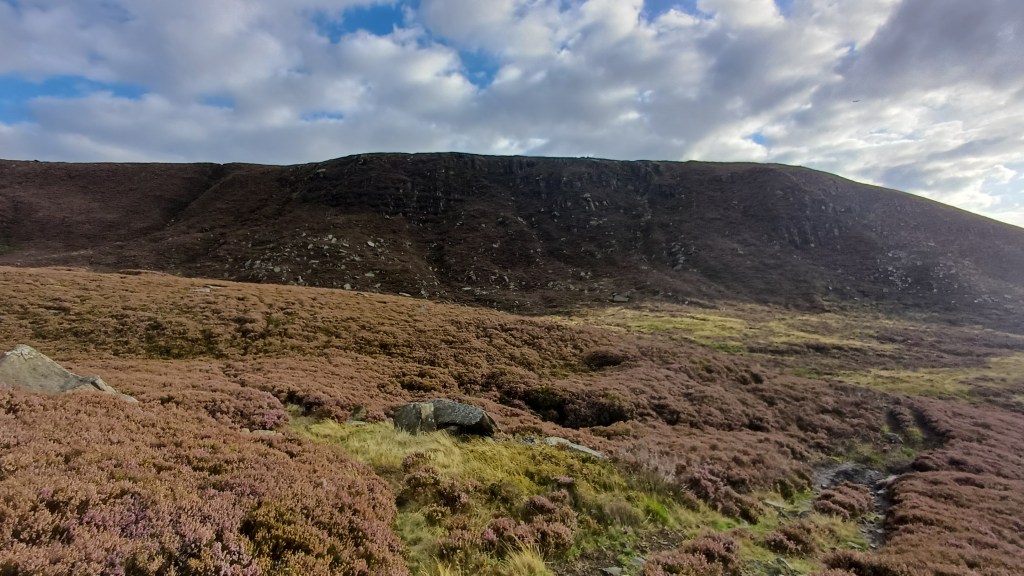
A guide to scrambling the Lawrence Edge gullies south of Woodhead Reservoir in Longdendale in the Peak District. Summary: a pair of short, enjoyable grade 1 scrambles with several harder sections, best combined with other nearby Dark Peak scrambles.
Approach / parking: park at the south end of the dam between Woodhead and Torside reservoirs and head along the road just south of the Transpennine Trail. Alternatively, park at Torside Car Park and walk along the Trail to the dam parking spot but that adds 25 mins each way. Use the quarry track that runs up the hill: either at the gate at OS map ref SK 08245 99325 (Lat, long: 53.49058, -1.87720), or starting via the quad-bike tracks from c.SK 08440 99434 (53.49155, -1.87425). Follow the quarry track as it bends round to the right, and then walk across country to the start of Lawrence Edge gully no.2
Note 1: there are at least five gullies running up Lawrence Edge. Only two are worth scrambling. The left-most deep groove is called Lawrence Edge gully no.1 in the ‘Scrambles in the Dark Peak’ book. The right-most gully (if you ignore the half-gully to its right) is Lawrence Edge gully no.2
Note 2: in the ‘Scrambles in the Dark Peak’ book, the mapped route for gully no.1 is in the wrong place: the actual gully is to the left/east of what’s shown
Start points: SK 08532 98625 (53.48428, -1.87288) for gully no.2; SK 08748 98522 (53.48335, -1.86964) for gully no.1
Grading: standard grade 1 over rocks with no real pitches for gully no.2 but grade 2 if you take the left fork for the final 30-40 metres; high end of grade 1 with several pitches for gully no.1
End points: for both gullies, where you reach the plateau, having climbed c.60m
Route between gullies: walk east along the top and then descend the Edge. It is longer but easier to walk down heading north-west from the edge path around SK 09070 98513 (53.48326, -1.86478); shorter but harder to climb steeply down to the west of gully no.1 starting from the edge path around SK 08695 98454 (53.48274, -1.87043)
Route out: descend the Edge via either of the routes above and then retrace the quarry track approach route
Route map: https://www.alltrails.com/explore/custom-routes/lawrence-edge-gullies-1bd3499
Time: less than 30 mins from dam parking to the gully no.2 start point; 15 mins to scramble; 15 mins to walk east and downclimb to the gully no.1 start point; 20 mins to scramble; then 30 mins to walk back
Warning: there are small sinkholes under and on Lawrence Edge, so watch your step
Combine with: Deer Knowl https://youtu.be/y9DDIrrUZFw, Shining and Stable Cloughs to the east https://youtu.be/4-mk5mDX90I; Wildboar Clough to the west https://youtu.be/IK9FFH2roHM
Gear: normal scrambling gear
Verdict: an enjoyable pair of scrambles that include a few challenges but are probably best combined with other scrambles in the area
Category: Standard scramble
Score: 6/10 for gully no.2; 7/10 for gully no.1
Video guide:
Map:
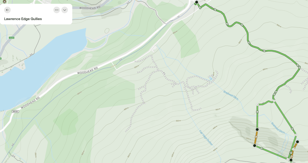
Map image/data from OpenStreetMap via AllTrails


Leave a Reply