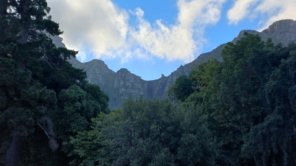
A section-by-section guide to hiking Dark Gorge on the east side of Table Mountain in Cape Town
Summary: not much of a scramble but great if you’re looking for a well-shaded adventurous hike in dry weather
Route in: start at Newlands Forest car park and find a route up (e.g. using the Woodcutters Trail for the final part) to the Newlands Forest Picnic Site on the Contour Path
Start point: turn left off the Contour Path up Dark Gorge just north of the Picnic Site (latitude: -33.96270, longitude: 18.43849)
Grading: almost the entirety of the gorge is hiking either up rocky steps or over rocky boulders that involves at most “sclambering”; at the very end there is a short section of c.grade 1 scrambling
Warning: there are a number of potential dangers to watch out for. Mugging is very rare but can occasionally happen; hiking in groups or at weekends when it’s busier may help. As per the name, it’s shady almost all the way up Dark Gorge but coming down Newlands Ravine you are quite exposed at first, so prepare for sun in good weather, and take sufficient water in all weathers. Mist can come down suddenly and it’s possible to lose your way on the top: watch the weather forecast and weather. High winds tend not to be too much of a problem in the gorge itself but can be up at the top of the mountain. During or after wet weather and more generally during colder months, the rocks can be slippery and dangerous with much more care needed. Injuries are infrequent but do happen. Check updates via groups like Friends of Table Mountain: https://www.facebook.com/groups/thefriendsoftablemountain
End point: where the gorge reaches the Saddle between Table Mountain and Devil’s Peak (latitude: -33.95933, longitude: 18.43344); total elevation gain of around 320 metres up the gorge (plus 300 metres more ascent from the car park to the start of the gorge)
Route out: it’s worth a detour east to sit on Pulpit Rock then leaving three options: easiest is heading slightly west and then down Newlands Ravine (a set of steps similar to Platteklip Gorge); you could downclimb Dark Gorge that’s hard so why would you; if you don’t need to return to Newlands, you can walk north to Saddle Rock then west and north down the Saddle Path to Tafelberg Road
Map link: https://www.alltrails.com/explore/custom-routes/dark-gorge-pulpit-rock-newlands-ravine-db0caf6
Time: about 1 hour from the car park to the start of the gorge; then c.1.5 hours up Dark Gorge; and around 1.5 hours down Newlands Ravine or about 1 hour over the Saddle to Tafelberg Road
Combine with: hike up Devil’s Peak, or along north-side Contour Path and up Platteklip Gorge to the Table Plateau. Note there are no hiking routes or even basic scrambling routes up Table Mountain from the Saddle: it’s rope-based climbing only
Gear: nothing special – just decent footwear and enough water and sun protection especially for time spent above/outside the forest
Verdict: not much of a scramble but great if you’re looking for a well-shaded adventurous hike in dry weather
Category: Standard
Score: 6.5/10
Video:
Map:
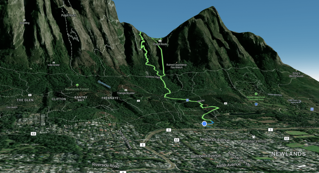
Map image/data from OpenStreetMap via AllTrails

Leave a comment