
Guide to hiking around mountain lake Sandsdalsvatnet on Gimsøya in the Lofoten Islands. Summary: a short, fairly-easy hike to a beautiful lake and mountain amphitheatre
Route in: park in a small lay-by (lat, long: 68.30766, 14.25198) on the Barstrandveien/7624 road just under 2km north of Ytre
Start point: along the muddy footpath with a signboard at the north-west end of the lay-by
Mid point: Sandsdalsvatnet (which I think means Sand Valley Water)
Route out: retrace your steps taking the same route out
Map link: https://www.alltrails.com/explore/map/sandsdalsvatnet-lake-loop-0aed23d
Time: the overall route took me 2.5 hours: 1 hour to the lake, just under 1 hour around the lake, and 30 mins back to the parking spot
Grading: this is a hike not a scramble but some basic scrambling over boulders and scree is needed if you circumnavigate the lake. It’s a short hike overall: 3km long and 200m of ascent and then descent; shorter if you just walk up to the lake and back
Note: there are options for wild swimming and wild camping around the lake. On some maps, the lake is called Stengelvatnet
Warning: rock surfaces on the path are often slippery. While the hike is not particularly weather-dependent, you can check the weather forecast: https://www.yr.no/en.
Gear: standard half-day hiking gear
Verdict: a pleasant, quiet, easy (by Lofoten standards) hike to a clear, picturesque lake set in within a close horseshoe of mountains
Category: Trek
Score: 7/10
Video guide:
Map:
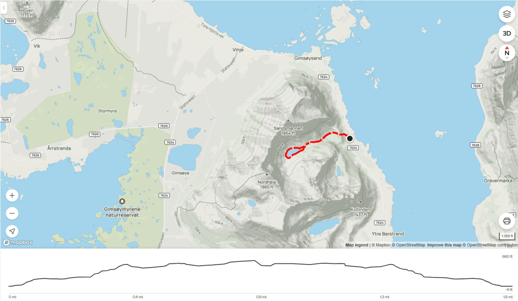
Map image/data from OpenStreetMap via AllTrails

Leave a comment