
Guide to scrambling Shining Clough south of the Woodhead Reservoir in the northern Peak District. Summary: satisfying grade 1, 1.5 and 2 scrambling in a little-frequented clough that’s overshadowed by its more-accessible neighbour, Wildboar
Route in: park at the south end of the dam between Woodhead and Torside reservoirs and head along the road just south of the Transpennine Trail. Alternatively, you can park at Torside Car Park and walk along the Trail to the dam parking spot but that adds 2 x 25 mins to the approach
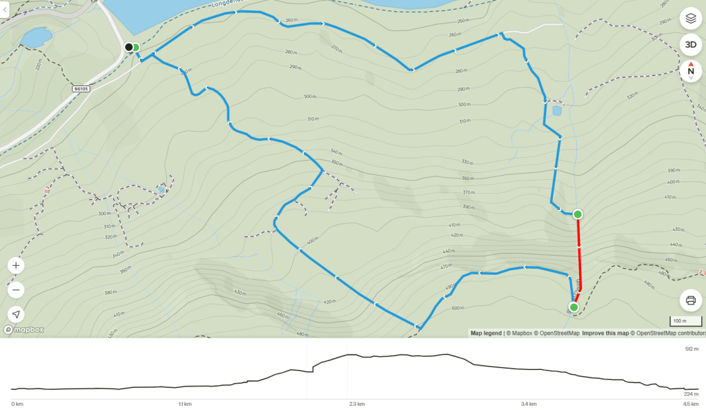
Start point: you can enter the clough in the second set of woods, around OS ref SK 09557 98936; but better to enter further up the clough around SK 09555 98793
Grading: one grade 2 pitch; a few grade 1 / 1.5 pitches; a grade 1.5 bypass route to the unscrambleable overhung wall
Warning: after rains, all of the pitches become waterfalls, and slippery ones at that
End point: where the clough meets the cross-path at SK 09556 98530; having completed 350ft of ascent
Route out: most people head west using the cross-path along the top of Deer Knowl, then descend between Deer Knowl and Lawrence Edge (no marked path) and link up with the quarry/shooting track that runs north-east and then north-west back to the parking. Or you could try your luck going east on the cross-path and then down the shooting track that descends by Stable Clough and past The Lodge
Map link: https://www.alltrails.com/explore/map/shining-clough-9219adc
Time: 40 mins from CP to start point; 40 mins for the scramble; then about 45 mins to walk back
Combine with: Wildboar Clough; Deer Knowl; Lawrence Edge; maybe Stable Clough
Gear: climbing helmet recommended; drybag and wetsuit only after rains
Verdict: some enjoyable grade 1 and grade 2 scrambling but disappointing unclimbable wall and nearby Wildboar Clough is easier to access with slightly better scrambling
Category: Standard scramble
Score: 7/10
Video guide:
Map:
Map image/data from OpenStreetMap via AllTrails

Leave a comment