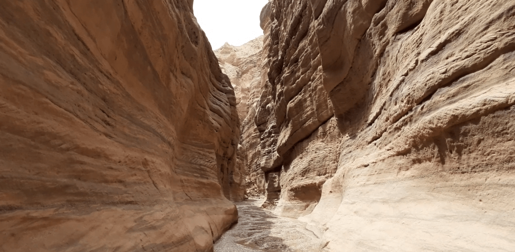
A multi-hour hike out-and-back along Wadi Numeira in Jordan. Summary verdict: good for about a 1.5 hour walk in, and then back again; beyond that, nothing much of real interest
Route in: drive left along a dirt track off the Jordan Valley Highway at coordinates 31.136586, 35.527892
Start point: the car park and start point of the wadi are around coordinates 31.132127, 35.531881
Grading: there is nothing difficult here; water was around ankle-deep; there’s a boulder climbed using a strong set of iron staples, and another much further on that requires a bit of a clamber
End point and route out: this is an out-and-back route so you end where you started
Time: I’d recommend walking a maximum of 90 minutes up the wadi and then returning. There’s a site where people have cooked and maybe camped about 2.5 hours in and you could walk a lot further than that if you wanted
Verdict: quite easy and can readily be hiked solo and unguided – the siq at the start is the best bit, though the litter also drops off the further you enter the wadi
Video guide:
Map:
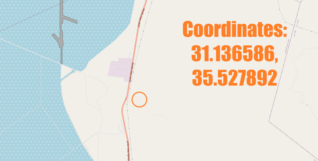
Map image/data from OpenStreetMap

Leave a comment