A c.two-hour hike out-and-back along Wadi Attun in Jordan. Summary verdict: fantastic hike with interesting and challenging warm-/hot-water waterfalls to ascend and descend
Route in: park on disused old part of Jordan Valley Highway to the West of the current Highway at coordinates 31.544932, 35.556785
Start point: carefully cross the road, descend the sides of the road bridge at coordinates 31.545006, 35.557431; assuming the wadi has not been fenced off
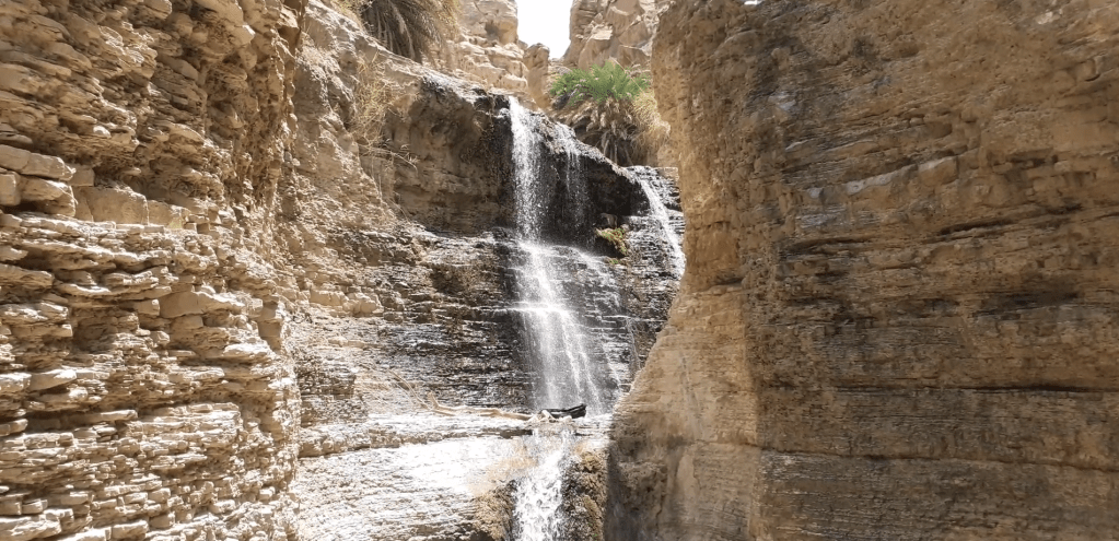
Grading: a 2 or 2.5 grade. There are maybe around six moderately-difficult small waterfalls to climb (hard because they are so slippery – the water pipe can help but beware rusty nails on some parts). Then two harder ones. One around 30-feet high you can use the rope that someone has kindly left: in UK terms this is at least a Grade 2 climb and you have to quasi-abseil on the way back down. The other maybe 15-feet high but slippery with few foot- or handholds and, damn, the water is hot. Above that, then the stream dries out and you reach roughly a dead end (you can scramble out to the side but I got to the top and couldn’t see the value of continuing further).
End point and route out: this is an out-and-back route so you end where you started
Time: it takes about one hour to reach the dead-end dry waterfall. You can find a spot for lunch there and take maybe 40 minutes to return.
Verdict: great wadi and my favourite so far in Jordan given the challenge of getting up and down the waterfalls solo. For a solo hike, you’d need to take some care. I saw no-one at all the whole time in the wadi, and you are one twisted ankle away from being stuck.
Score: 9/10
Video guide:
Map:

Map image/data from OpenStreetMap

Leave a comment